The sea, explained
What is the Sargasso Sea?
The Sargasso Sea is the only sea on Earth defined by currents instead of coastlines: a vast, calm patch of the open North Atlantic named for the sargassum seaweed that drifts across its surface. It is also the source of a common mix-up. The seaweed smothering Caribbean and Florida beaches in recent summers does not come from the Sargasso Sea; it comes from a newer, separate bloom far to the south. Here is what the Sargasso Sea actually is, and how the two are related.
A sea bounded by currents, not land
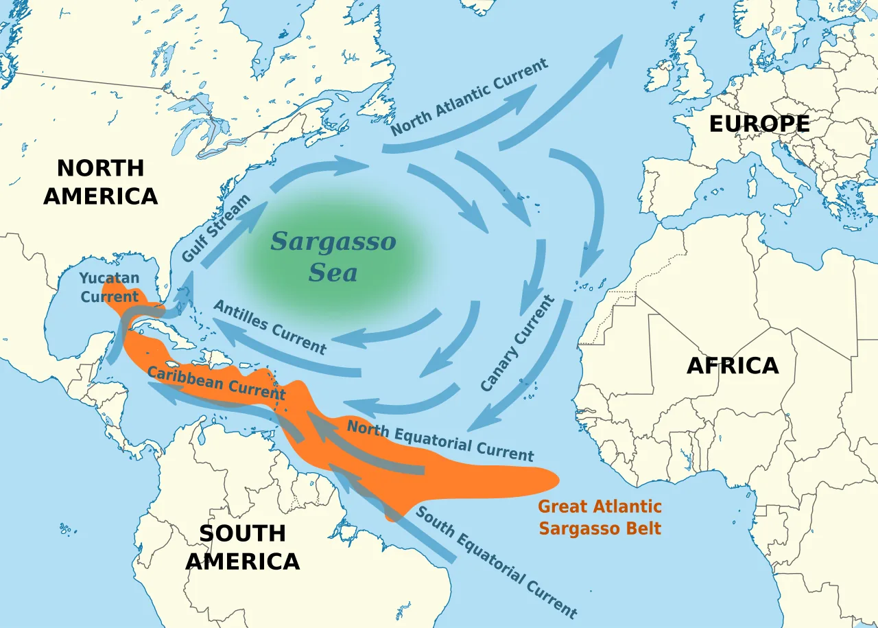
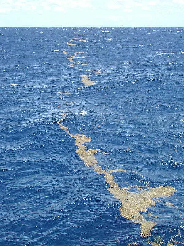
Every other sea on the map has a shore. The Sargasso Sea has four currents instead: the Gulf Stream to the west, the North Atlantic Current to the north, the Canary Current to the east, and the North Atlantic Equatorial Current to the south. Together they form a slowly rotating gyre that encloses a region roughly 1,000 miles wide and 3,000 miles long, with Bermuda near its western edge. Inside the gyre the water is unusually calm, clear, and deep blue, and floating sargassum collects across its surface. NOAA Ocean Service source.
A floating golden ecosystem
Out there, the seaweed is the habitat. NOAA describes sargassum mats as food, shelter, and breeding grounds for fish, sea turtles, seabirds, crabs, and shrimp, including species found nowhere else, like the sargassum fish, an anglerfish camouflaged to vanish among the fronds. Young loggerhead sea turtles spend early years sheltering in the mats. Both American and European eels migrate to the Sargasso Sea to spawn, a journey of thousands of miles that scientists still do not fully understand. NOAA Ocean Service.
Sailors have described the region since Columbus crossed it in 1492, and its reputation for becalming ships fed centuries of sea lore. The modern reputation is kinder: conservationists often call it a golden floating rainforest, and since 2014 a group of governments has cooperated to protect it under the Hamilton Declaration, coordinated by the Sargasso Sea Commission.
No, it is not what's on your beach
The natural assumption is that Caribbean beach seaweed drifts down from the Sargasso Sea. It does not. The rafts hitting beaches from the eastern Caribbean to Mexico and Florida come from the Great Atlantic Sargassum Belt, a separate recurring bloom in the tropical Atlantic between West Africa and the Americas that first appeared around 2011, well south of the Sargasso Sea. Researchers who tracked the belt's emergence in satellite data found it recurring every year since, in some years holding more than 20 million metric tons of seaweed. Wang et al., Science (2019), NASA Earth Observatory.
The distinction matters for trip planning. The Sargasso Sea sits in the mid-Atlantic and mostly keeps its seaweed; the belt is the system that loads the Caribbean, the Gulf, and Florida each spring and summer. When you check our live sargassum map or a destination page, the belt is what you are looking at.
What this means for your trip
editorial Three takeaways:
- Bermuda is not the Caribbean. Sitting inside the Sargasso Sea does not put Bermuda in the belt's main delivery path; its seaweed picture differs from the eastern Caribbean's.
- The seaweed itself is normal. Sargassum has drifted in the Atlantic for centuries. What changed around 2011 is where and how much of it blooms. The full story is in What is sargassum?
- For beach conditions, watch the belt. Season patterns are in the season guide, and current risk levels for 59 destinations are on the atlas map.