The bloom, explained
What is the Great Atlantic Sargassum Belt?
The Great Atlantic Sargassum Belt is a band of floating seaweed that now blooms across the tropical Atlantic every year, stretching up to 5,000 miles from West Africa to the Gulf of Mexico. It did not exist in satellite records before 2011. It is the reason Caribbean beach seaweed went from an occasional nuisance to an annual season, and it is the system this atlas tracks. Here is what it is, why it formed, and how it reaches your beach.
A bloom the width of an ocean
Scientists at the University of South Florida named the belt after finding it in nearly two decades of satellite imagery: a recurring summer band of sargassum spanning the Atlantic's tropical latitudes, holding more than 20 million metric tons of seaweed in its biggest early years. Before 2011, the imagery shows almost nothing there; since 2011, it has bloomed every year but one. Wang et al., Science (2019), NASA Earth Observatory.
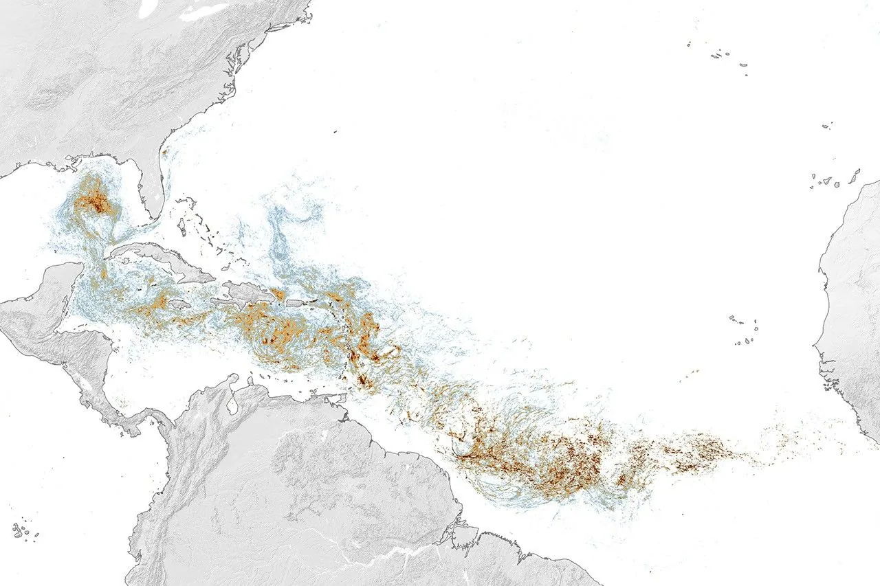
Despite the similar name, the belt is not the Sargasso Sea. The Sargasso Sea is a calm mid-Atlantic region where sargassum has always collected; the belt is a newer, separate bloom far to its south, and the belt is what feeds beach landings from Barbados to Cancún to Florida.
Why it formed
Researchers point to a shift that began with an unusual ocean-circulation event in 2009 and 2010, which appears to have seeded sargassum into tropical waters where nutrients let it thrive. What sustains the bloom year after year is still being studied; the leading suspects are nutrient inputs including Amazon River discharge, dust blowing off the Sahara, and seasonal upwelling off West Africa, in combinations that vary by year. None of this is settled science yet, which is one reason year-to-year bloom size stays hard to predict. Wang et al., Science (2019), NASA Earth Observatory.
The annual cycle, and where the seaweed goes
The belt follows a fairly regular calendar: seaweed amounts build through winter and spring, peak around June and July, and fade through fall to a winter minimum. As the bloom grows, currents and trade winds carry portions of it west and north, into the eastern Caribbean first, then the western Caribbean, the Gulf of Mexico, and Florida. That travel time is why eastern islands like Barbados often see landings weeks before the Mexican Riviera. The month-by-month pattern, and how much year-to-year luck is involved, is in our season guide.
2026 showed what the belt looks like at full strength: record satellite totals in January, February, and March, with roughly 9 million metric tons in the eastern Caribbean and 5 million in the Gulf by June, nearly double the Gulf's previous record. WUSF, WGCU.
How the belt is tracked from space
Sargassum reflects light differently from open water, so satellites can map floating rafts across the whole Atlantic. The University of South Florida's Optical Oceanography Lab publishes monthly outlook bulletins from that imagery, and NOAA produces weekly risk products for coastal waters; our atlas builds its daily destination risk levels on NOAA's data. Satellites see offshore rafts, not the sand in front of your hotel, which is why every destination page pairs the risk level with live beach cams. USF Sargassum Watch System, NOAA Sargassum Inundation Report, and our own methodology.
What this means for your trip
editorial The belt is a probability machine, not a schedule:
- A big belt raises the odds; it does not doom every beach. Coast orientation still dominates: windward, east-facing shores catch the most, and leeward coasts are often clear in the same week. See where beaches stay clearer.
- Timing beats geography for spring trips. Early in the year the belt is usually still building, which is why March and April trips tend to land ahead of the worst. The spring break guide has a check-as-you-go routine.
- Check the map, not the headlines. Belt coverage in the news describes ocean totals. What matters for your week is your coast, so use the live sargassum map and your destination's page and cams.