Cuba · north-facing
Varadero
High
Head to head editorial
Varadero has a modest geographic edge: the Hicacos peninsula faces north toward the Straits of Florida, while the Cancun hotel zone faces the open Atlantic path.
The reasoning
An edge is not a shield. The satellite record on both pages below shows High readings at Varadero as well as Cancun in peak weeks, so treat the orientation difference as a tilt in the odds and let the current cards settle the week you are booking. Neither page has a verified cam yet, so a same-day photo from the resort is the closing move for either.
Right now
Both measured from NOAA's update of . Each card rates one specific stretch of coast; open a destination for the full picture.
Cuba · north-facing
Mexico · east-facing
The record
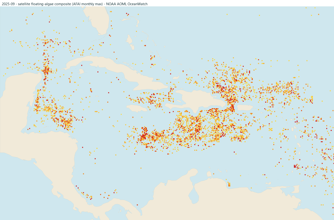
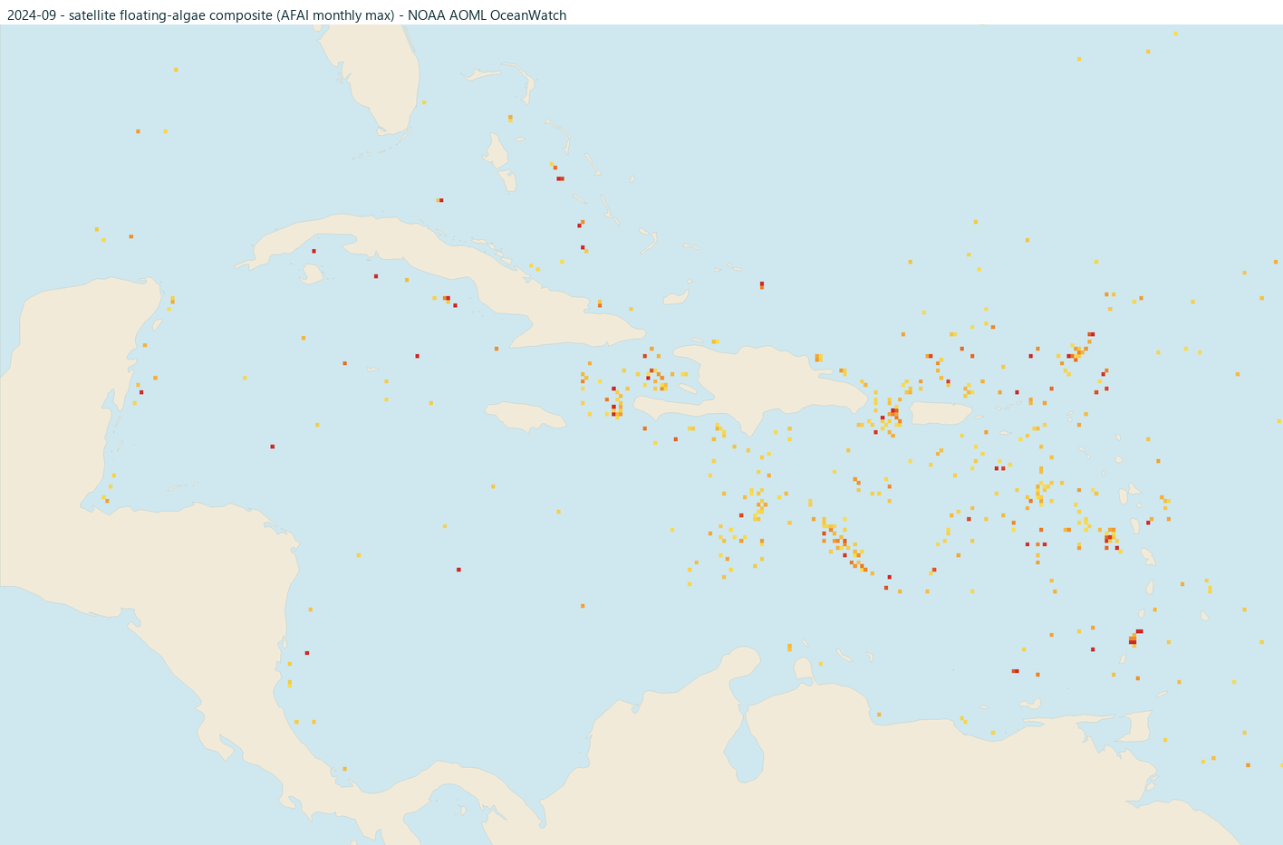
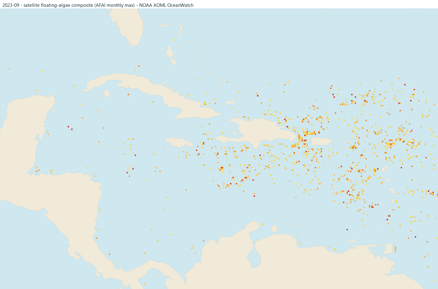
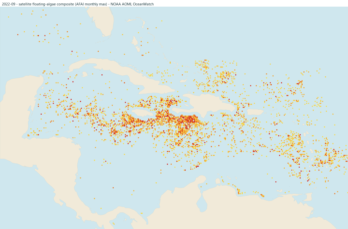
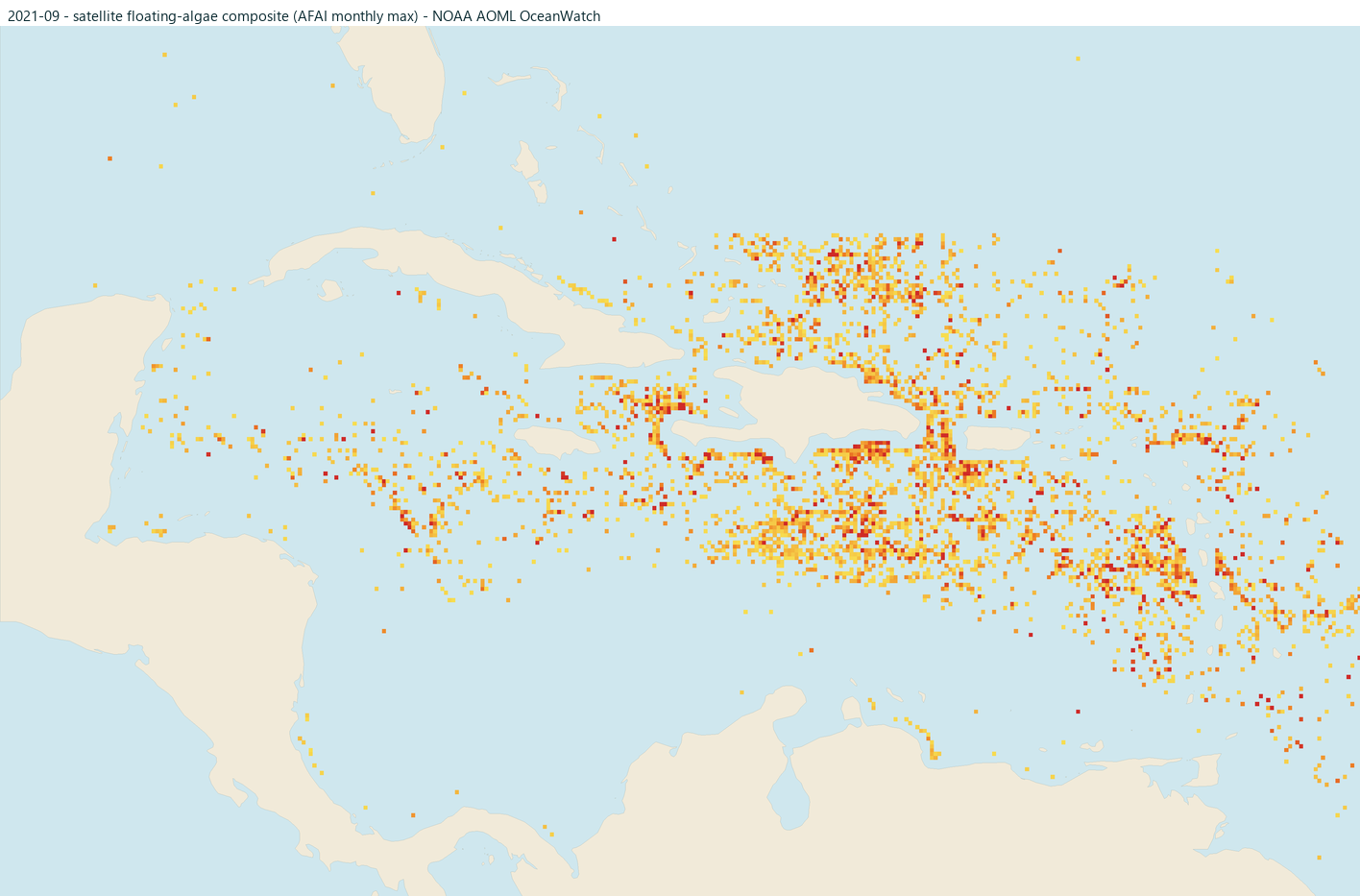
Raw satellite floating-algae detections near each coast for this month in each of the past five years (brighter orange and red = stronger signal). These are detections, not risk ratings: clouds and glare can hide algae, offshore mats do not always land, and the nearshore strip is blanked where the signal is unreliable. Click any map for that month's full Caribbean view.
Making the call
More head-to-heads on the compare page, or build a shortlist from scratch with where beaches stay clearer.