Jamaica · north-facing
Montego Bay
High
Head to head editorial
The Jamaica north coast has the more sheltered geography: Montego Bay and Ocho Rios face north, while the Punta Cana Bavaro strip faces the open Atlantic.
The reasoning
Coasts pointed into the Atlantic catch most of what drifts in; coasts angled away from it miss more. That favors the Jamaican north shore on the map, but it is a tilt in the odds, not a wall: north-facing coasts still post High readings, and any of these three cards can surprise in either direction on a given week. Check all three below, then the cams.
Right now
Both measured from NOAA's update of . Each card rates one specific stretch of coast; open a destination for the full picture.
Jamaica · north-facing
Jamaica · north-facing
Dominican Republic · east and northeast-facing
NOAA data did not cover enough of this coastline today for us to call a level.
The record
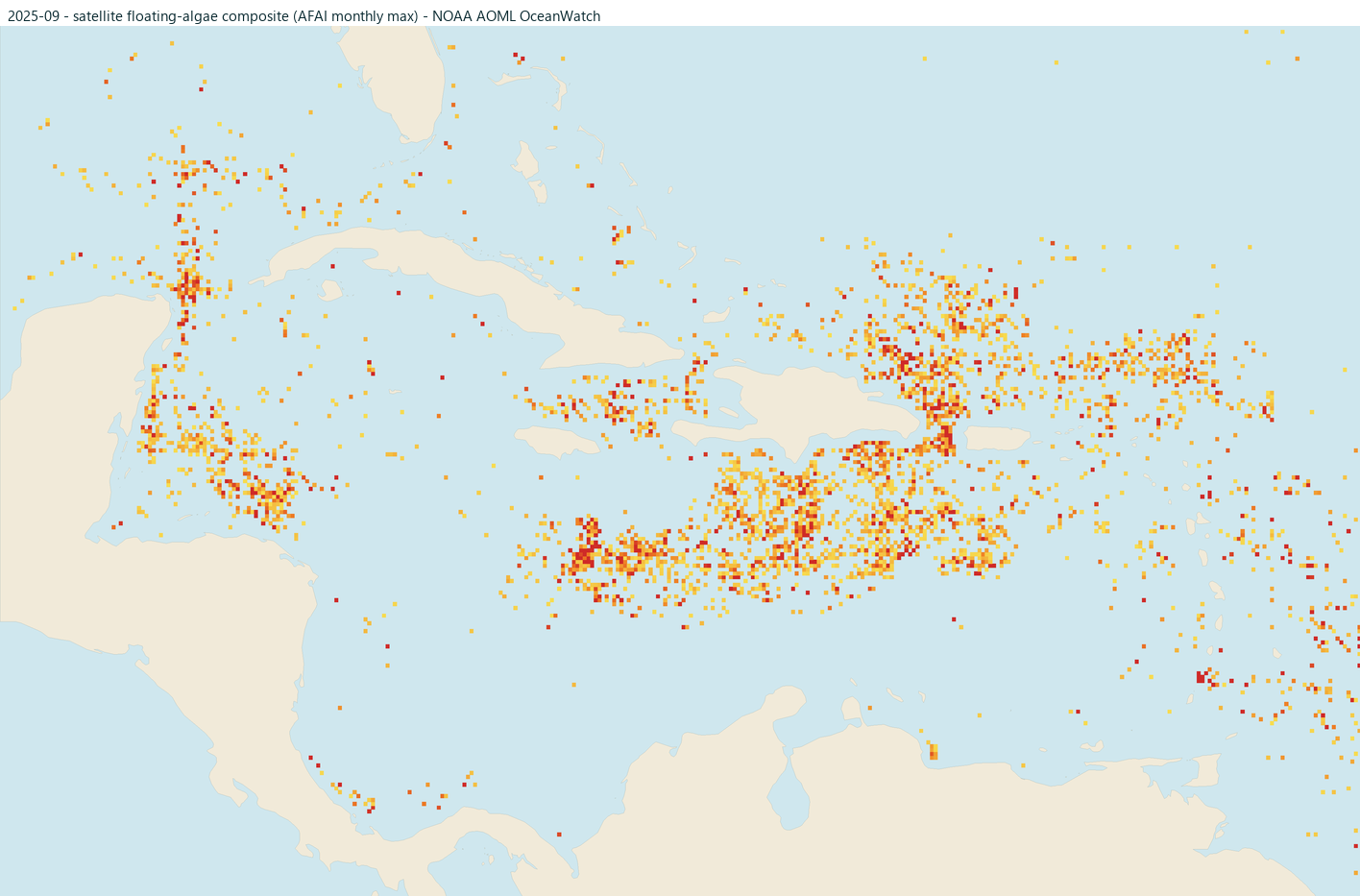
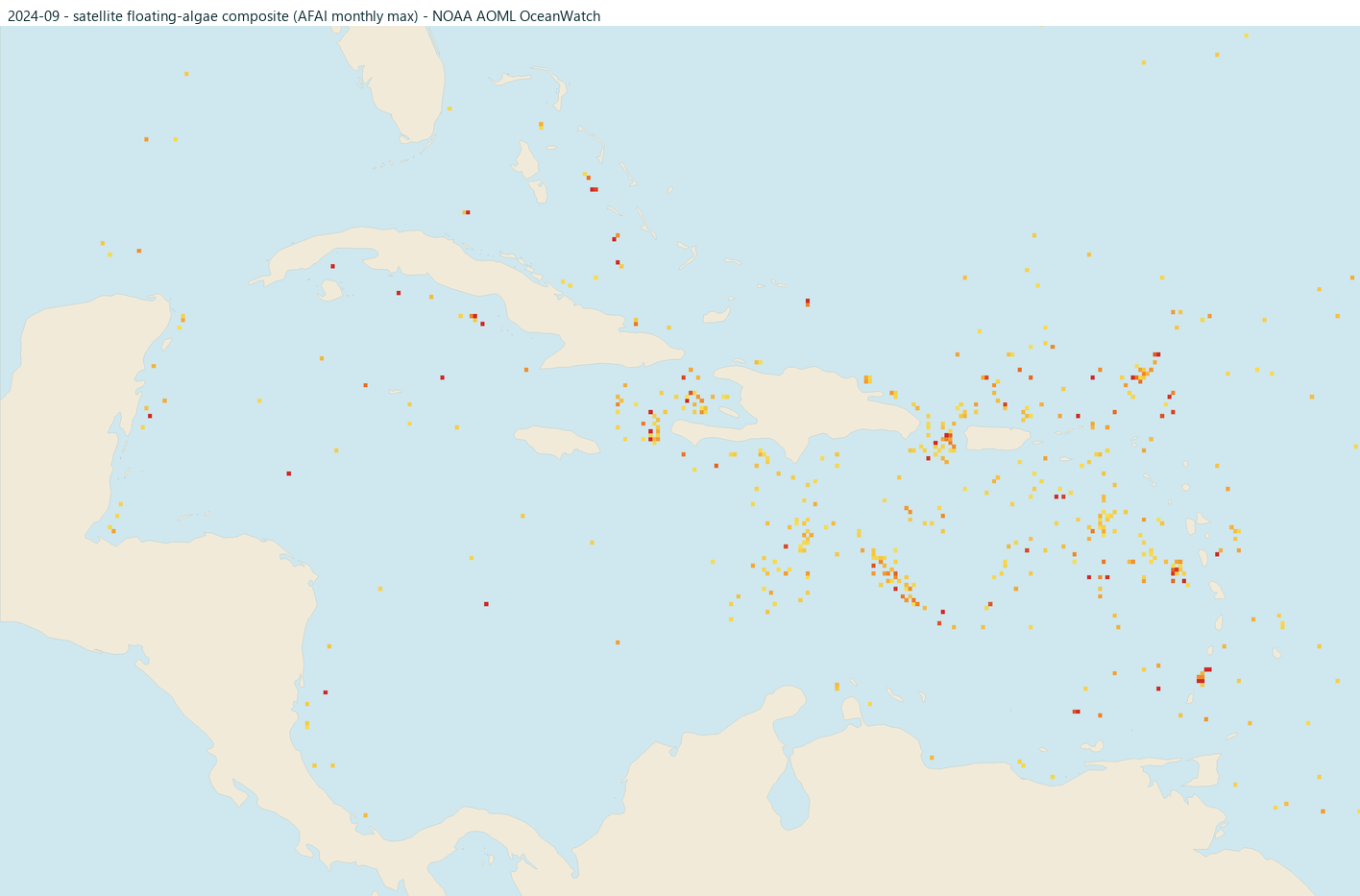
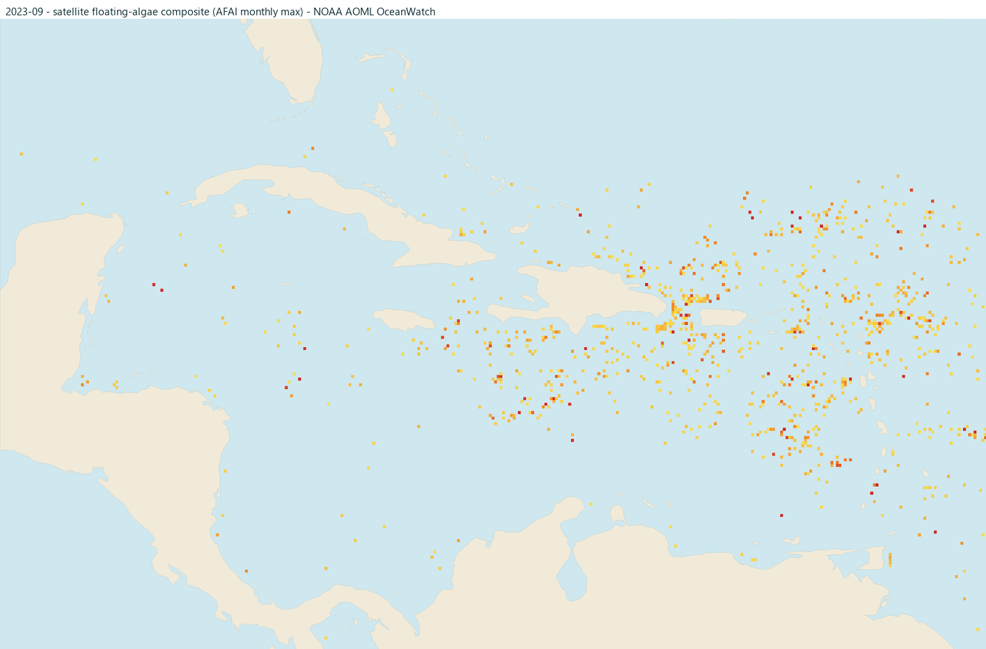
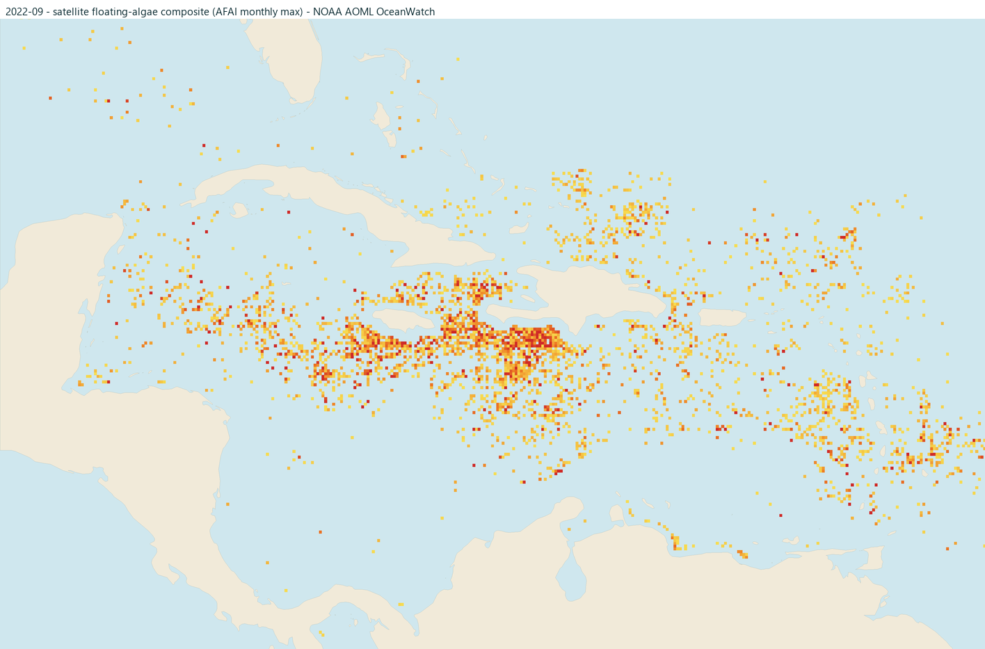
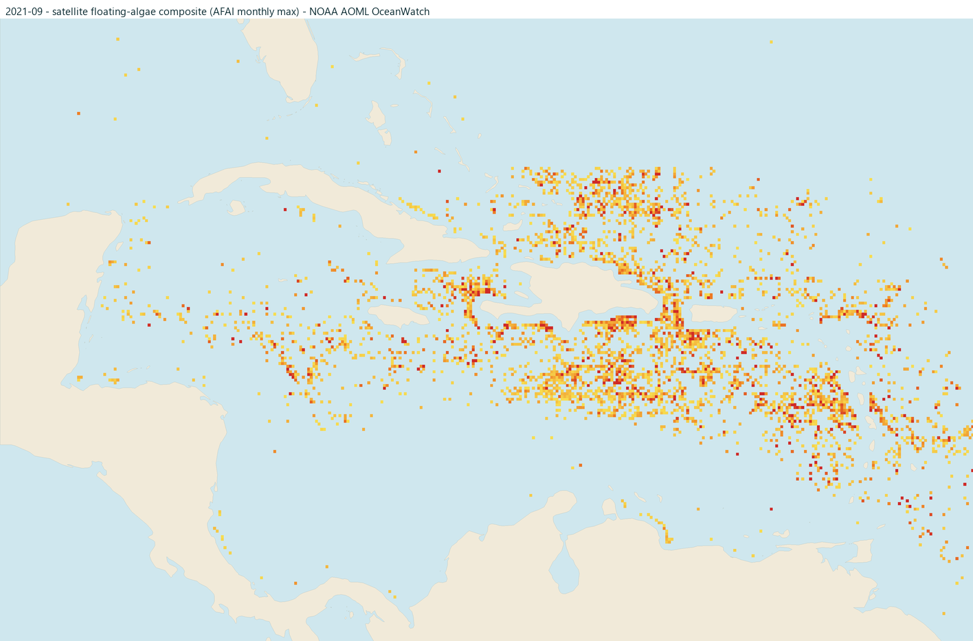
Raw satellite floating-algae detections near each coast for this month in each of the past five years (brighter orange and red = stronger signal). These are detections, not risk ratings: clouds and glare can hide algae, offshore mats do not always land, and the nearshore strip is blanked where the signal is unreliable. Click any map for that month's full Caribbean view.
Making the call
More head-to-heads on the compare page, or build a shortlist from scratch with where beaches stay clearer.